MiFi Maps Precision Tracking
High-precision tracking system with centimetre-level accuracy for safer and more efficient humanitarian demining operations
TL;DR
- Centimetre-level positioning accuracy
- Multi-rover tracking system
- Dual-antenna configuration for enhanced directional accuracy
- User-friendly mobile application interface
- Secure centralized data management
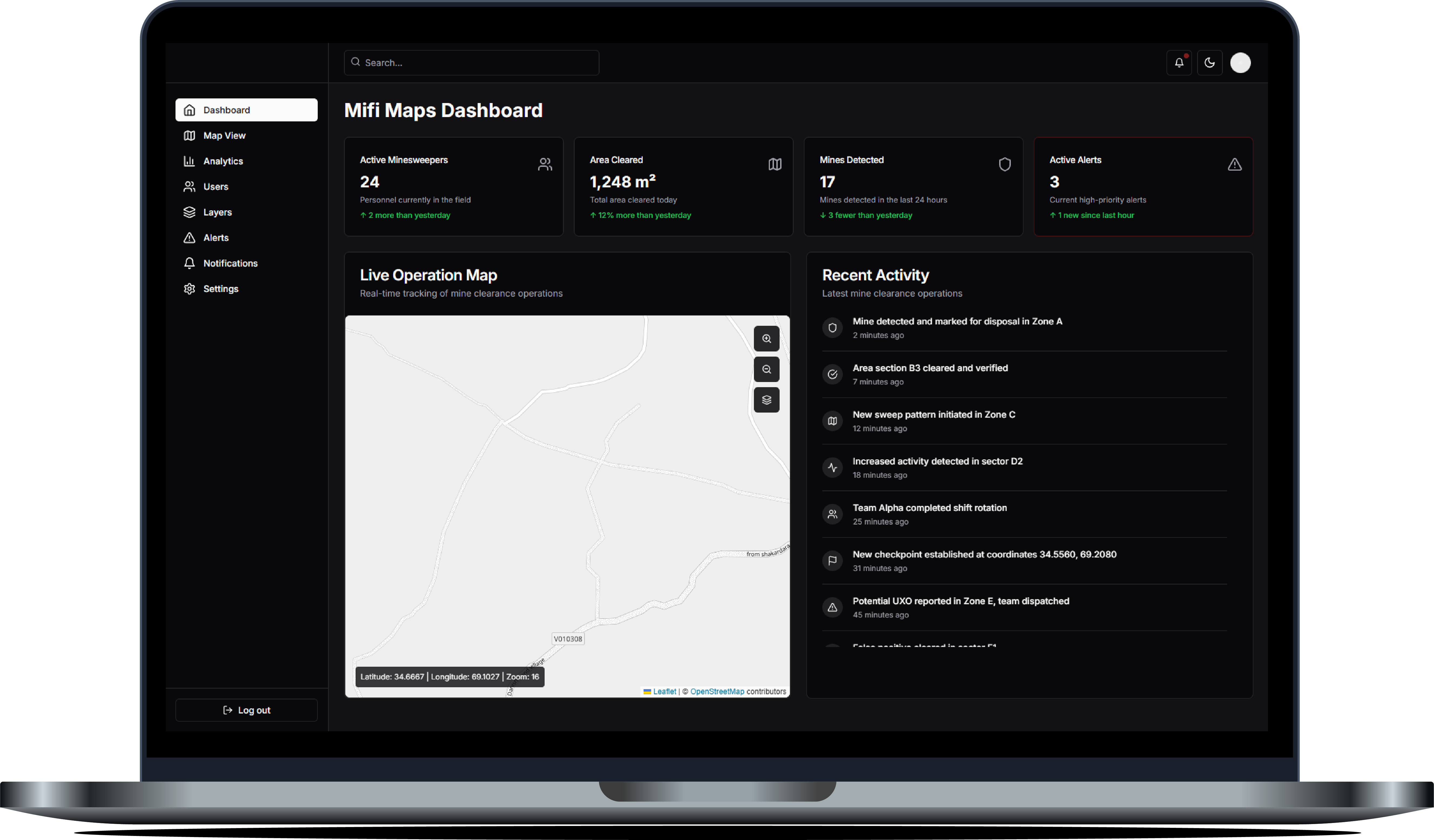
MiFi Maps tracking dashboard visualisation (in development)
MiFi Maps has introduced a revolutionary tracking system that brings centimetre-level accuracy to humanitarian demining operations. By leveraging real-time kinematic (RTK) technology alongside custom hardware, this comprehensive solution aims to make mine clearance safer, more efficient, and fully documented. MiFi Maps appointed our team at Nemiah to design, implement, and integrate the hardware and software components, ensuring a seamless, field-ready product.
The Challenge
Landmine clearance is painstaking, high-risk work that demands precise positioning for safety. Traditional GPS systems often lack the accuracy required in remote environments, and previous solutions struggled to maintain connectivity in challenging conditions. MiFi Maps tasked Nemiah with creating a lightweight, easy-to-use device capable of tracking multiple rovers in real time with centimetre-level precision.
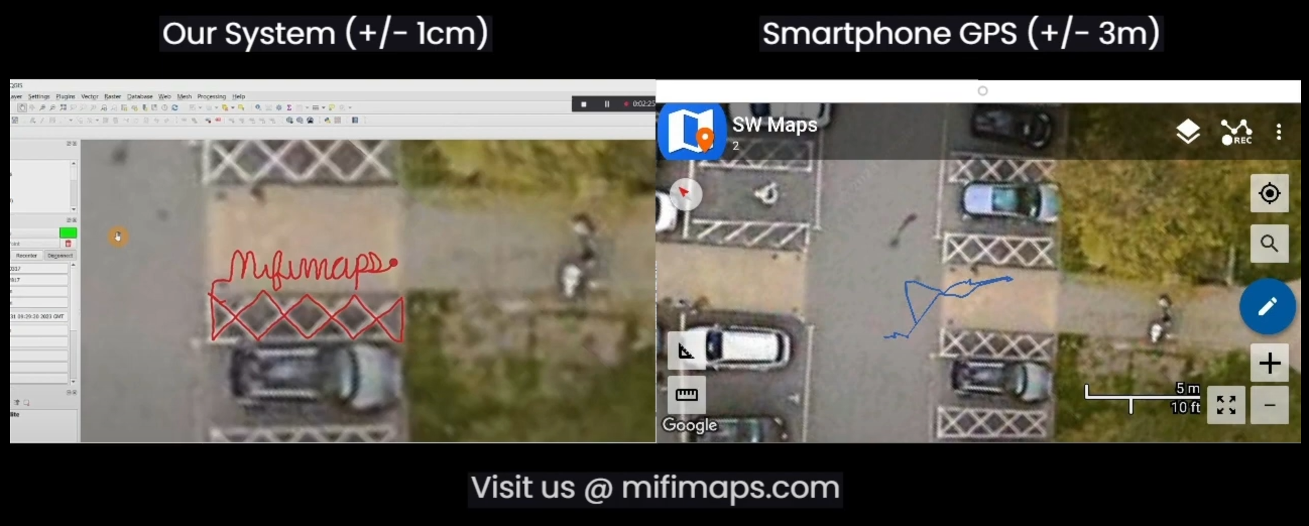
Centimetre accuracy of MiFi Maps Vs regular GPS
Our Implementation
To meet MiFi Maps’ requirements, we developed a comprehensive tracking system that features:
- Dual-Antenna Configuration: Incorporating two antennas significantly improves directional accuracy and helps operators maintain precise orientation.
- Integrated Control System: A single microcontroller manages all key components, reducing complexity for field teams and enhancing overall reliability.
- Robust Communications Protocol: We engineered a wireless protocol that maintains connectivity under remote and challenging conditions.
- Multi-Rover Tracking: The system simultaneously monitors multiple rovers, enabling larger coverage areas without compromising data integrity.
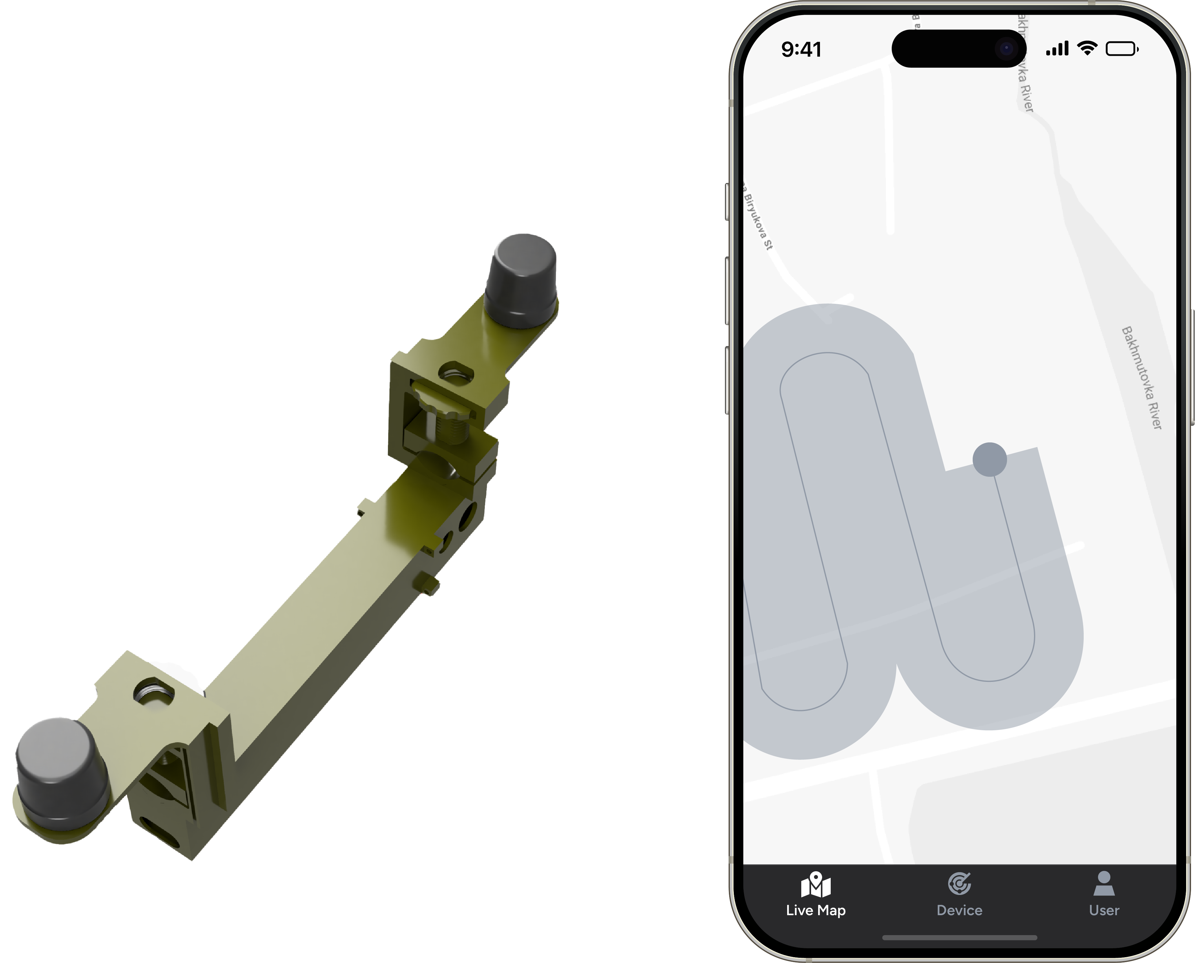
MiFi Field Device and App Integration
User-Friendly Interface
Understanding that ease of use is critical in high-pressure environments, we created an intuitive mobile application that offers:
- Real-time visualisation of rover positions
- Simple data export options
- Team coordination capabilities
- Progress tracking and access to historical records
- Comprehensive quality assurance tools
The Goal
The goal is for this cutting-edge system to become an integral part of active demining efforts. Once deployed, it will help document full coverage and provide pinpoint accuracy so that demining crews can work more confidently and efficiently—ultimately assisting communities in reclaiming land previously deemed too dangerous.
TL;DR
- Centimetre-level positioning accuracy
- Multi-rover tracking system
- Dual-antenna configuration for enhanced directional accuracy
- User-friendly mobile application interface
- Secure centralized data management


